
The coldest of the air settles in late Friday night. By daybreak Saturday, air temperatures along and east of US-131 will be between -10 and -15 degrees. Lake Michigan will keep locations closer to the shore a bit warmer with low temperatures between 0 and -10 degrees. The current record minimum temperatures for Jan. 24 in West Michigan are a little colder than projected temperatures, so it isn’t likely we’ll set new records, but we’ll be close. The dangerous cold prompted the National Weather Service to issue an “Extreme Cold Warning” for Ottawa, Kent, and Ionia counties north. In the Warning area, wind chills could dip to as cold as -30 (F) degrees. Exposed skin can freeze in as fast as 10 minutes in those conditions. For Allegan, Barry, and Eaton counties south, the Weather Service has issued a Cold Weather Advisory for wind chills as cold as -25 (F) degrees. Exposed skin can freeze in as little as half an hour.
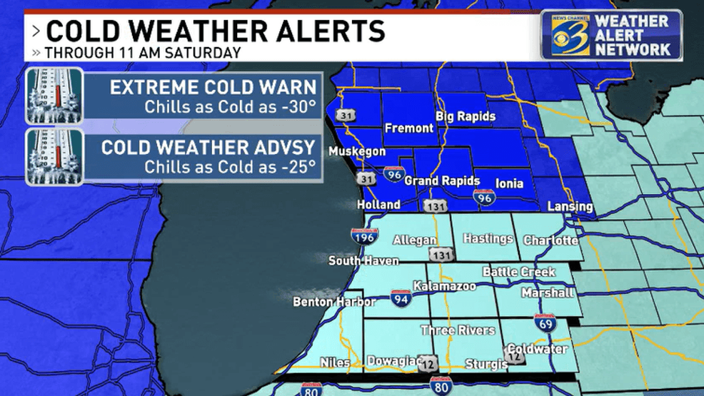
Extreme Cold Warning, Cold Weather Advisory for West Michigan (Courtesy: WWMT-TV)
Both the Cold Warning and Cold Advisory expire at 11 a.m. Saturday. Though forecast models show a gradual warming trend over the weekend, temperatures are expected to be considerably colder than average through the middle of next week.
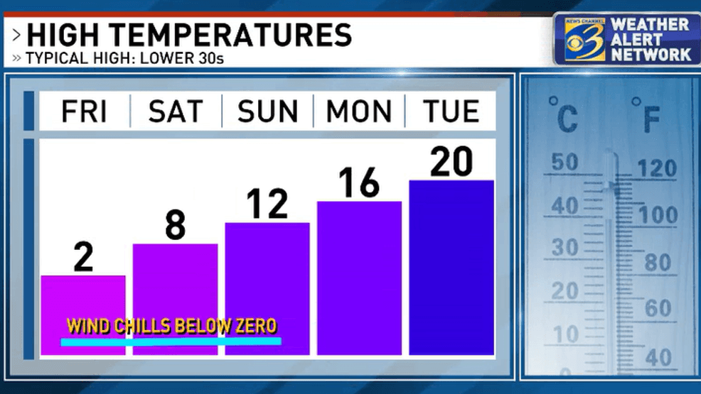
High temperature forecast shows rising temperatures next week (Courtesy: WWMT-TV)
BE THE FIRST TO COMMENT
The cold air crossing Lake Michigan will keep occasional snow showers in the forecast, but heavy snow isn’t expected. Stay with the News Channel 3 Weather Alert team of meteorologists for the latest winter weather updates.