Happy Saturday! There is a lot to talk about with our incoming nor’easter, so let’s break it down by snow, travel, wind, power outage risk and coastal flooding.
First flakes will fall in between 9 p.m. and midnight Sunday night.
The heaviest snowfall, reaching rates near 2 inches per hour, will be between 4 a.m. and 10 a.m.
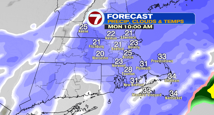
However, there will still be heavy snowfall from 3 a.m. to 3 p.m.
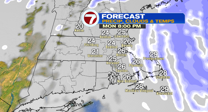
Snow chances linger all the way into Monday evening, but during that time the snow will lighten up a bit, more on the light to moderate side.
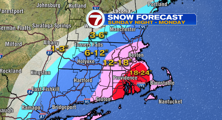
Snowfall totals! This is a coastal storm, so the highest amounts will be across southeastern Massachusetts where we could pick up up to 2 feet of snow. Right along the coast in Plymouth County, slightly less since the wind will have an effect on the snowflakes.
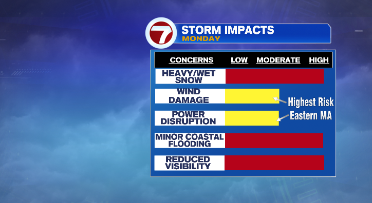
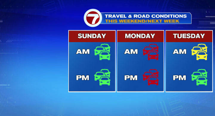
This heavy, wet snow will significantly impact travel. Let’s be clear: travel is not advised all day Monday. That’s from snow on the ground and blowing snow reducing visibility because of the wind.
This is a powerful nor’easter, so the wind is going to play a huge part as well.
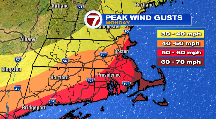
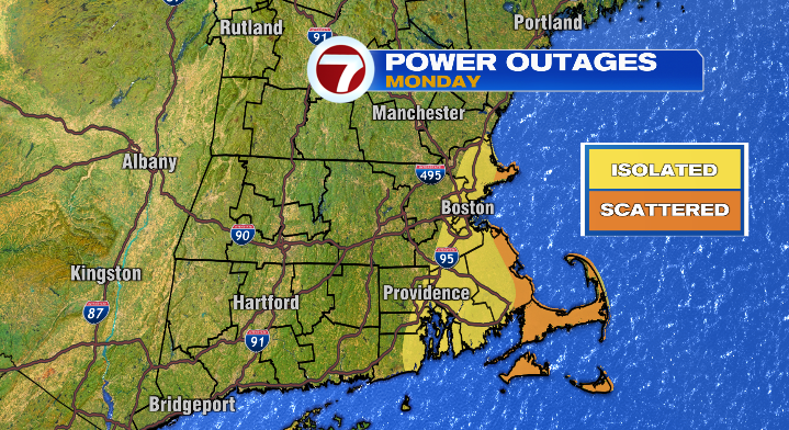
The peak wind gusts along the coastline in southeastern Massachusetts will top 60 mph. Elsewhere in eastern Massachusetts, 50-60 mph. As you go farther inland the wind will diminish in strength. Between the wind and the heavy, wet consistency, we can’t rule out scattered power outages along coastal areas.
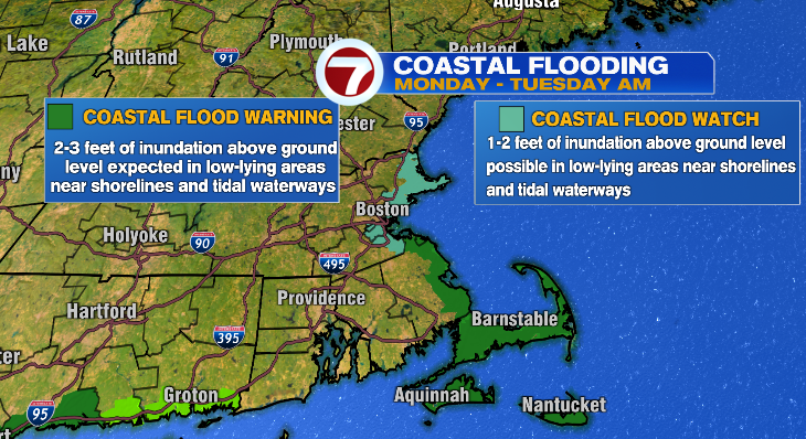
There is also a risk for minor coastal flooding with between 1 and 3 feet of inundation above ground depending on your location.