
The weight of this snow will be considerably higher than the previous storms this season due to higher surface temperatures and more water content. That increases the risk for tree damage and power outages.
Allow yourself time to safely remove the snow. If possible, make multiple passes with your shovel, plow, or snowblower.
TIMING
The heaviest snow continues through Monday morning. Snowfall rates of 2-3″ per hour are possible at this time, along with pockets of thundersnow!
The heaviest snow will move across the area Monday morning with rates of 2-3″/hour possible at times
Monday morning will feature bands of heavy snow along with powerful northeasterly wind gusts.
It might not be until 3 PM Monday when snowfall rates let up. However, light to moderate snow could linger until 11 PM.
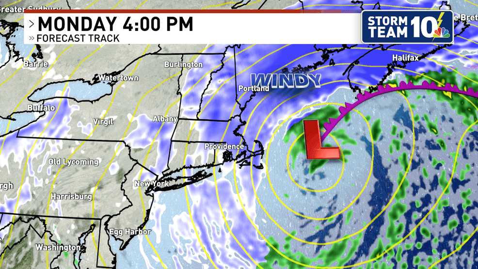
Still snowing as the sun begins to set on Monday, but the worst of the storm will be over. (WJAR)
WIND
The wind is going to play a major role in the forecast. Winds will be gusting 50-70 mph through Monday afternoon. Snow will be blowing and drifting, adding to the near-zero visibility. There is a high probability of blizzard conditions persisting for several hours.
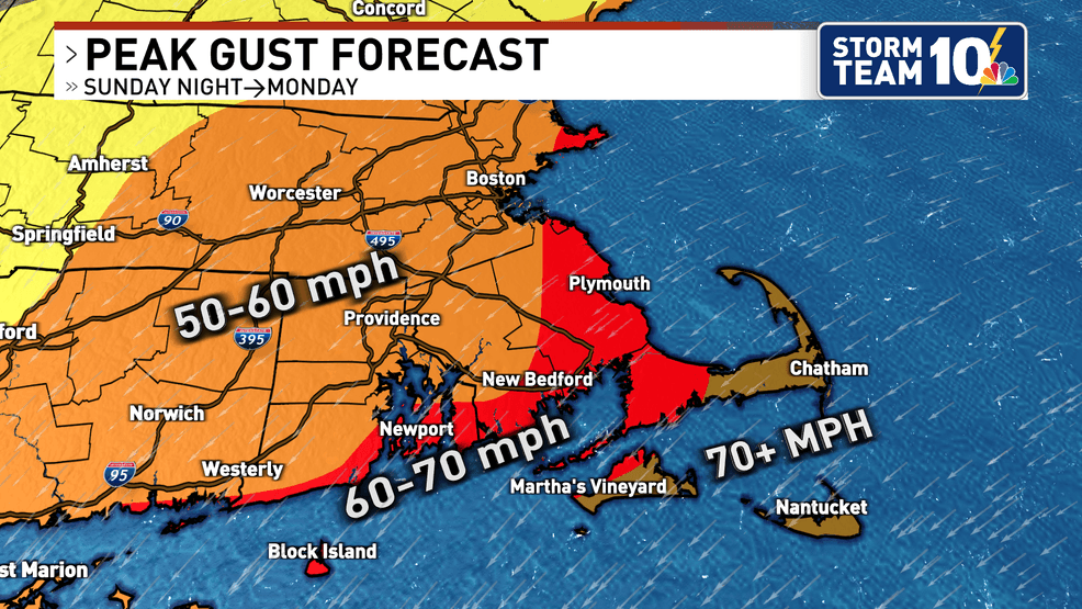
Power outages will be likely, especially along the south coastline. The combination of gusts of 60 mph or more and a wet, heavy snow may result in downed tree limbs and wires.
SNOWFALL
The snowfall forecast is increasing for Rhode Island and eastern Massachusetts, as the track of this Nor’easter will take it close to the “benchmark”, creating the perfect setup for a big snowfall.
A widespread 18 to 24 inches is expected across most of Rhode Island and southeastern Massachusetts, with 12 to 18 inches along the immediate south coast and towards the Cape Cod canal.
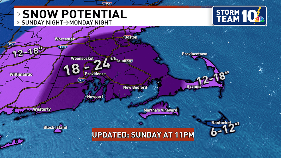
A widespread 18 to 24 inches of snow is expected across Southern New England. (WJAR)
TRAVEL
Expect this to be a major disruption to travel. Road conditions will deteriorate rapidly on Sunday night and could become impassable by Monday morning. This is not even factoring in the zero visibility from the blizzard conditions due to heavy snow and strong wind gusts.
Make sure to stay with Storm Team 10 for all of the latest on this nor’easter!