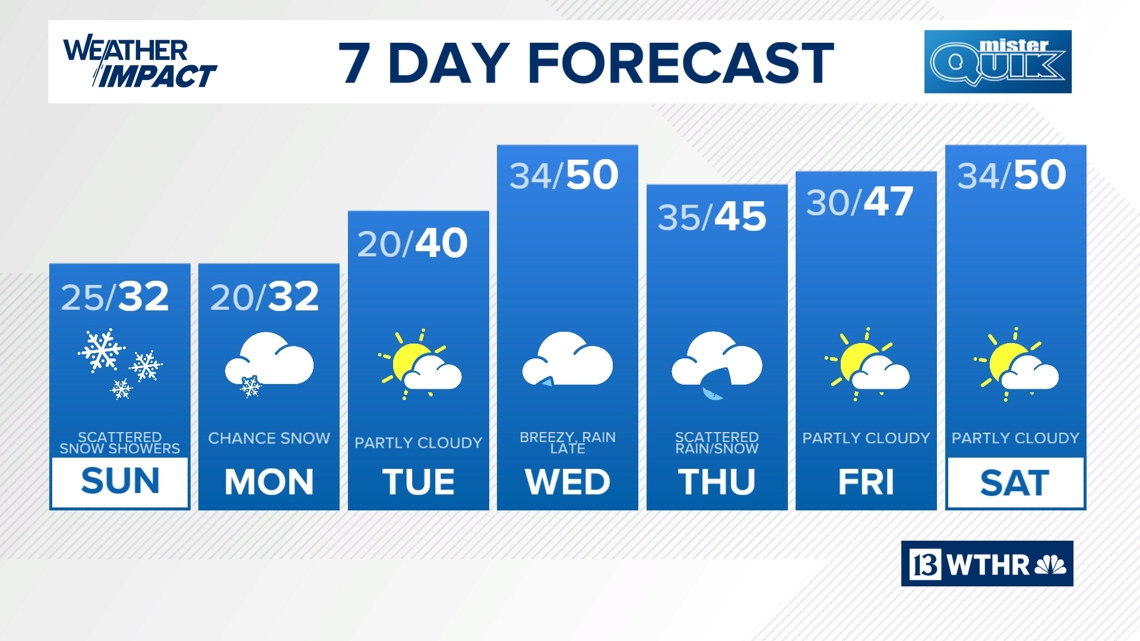
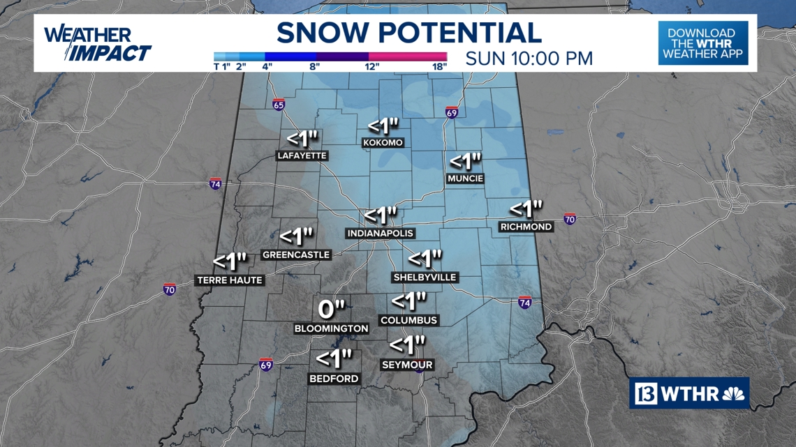
A chilly weekend is expected to bring a chance of light snow on Sunday, though most of Indiana can expect less than an inch of accumulation.
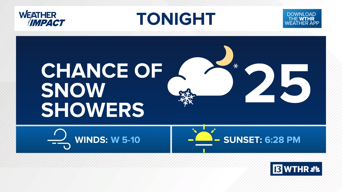
TONIGHT

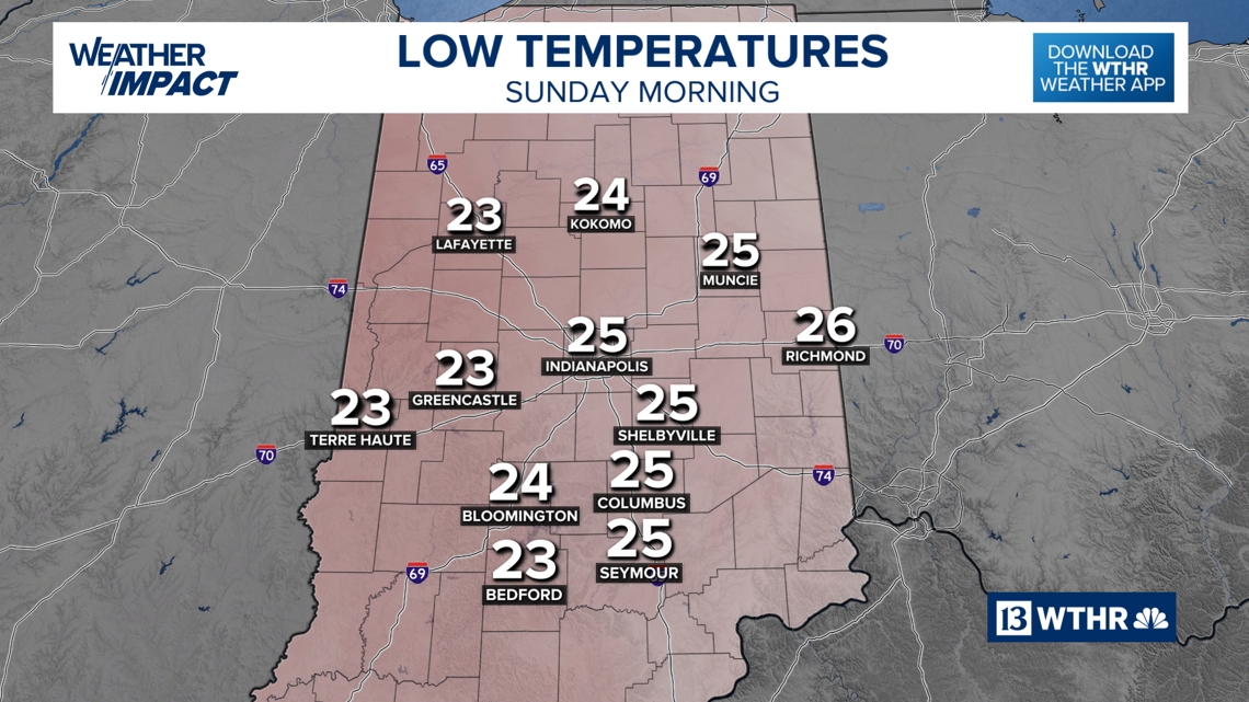
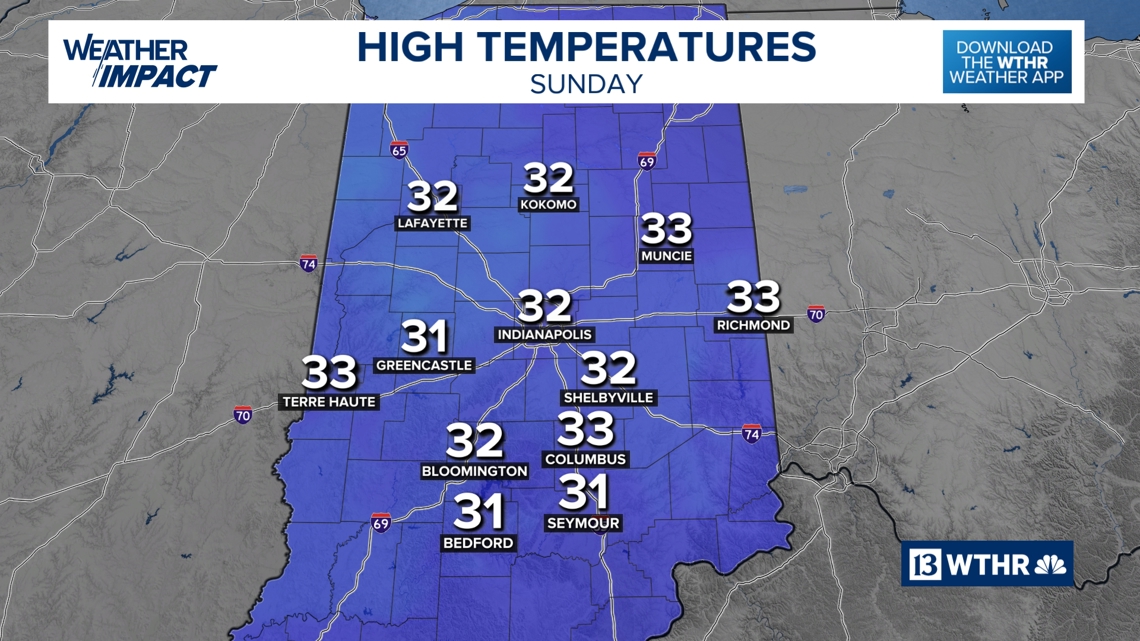
SUNDAY

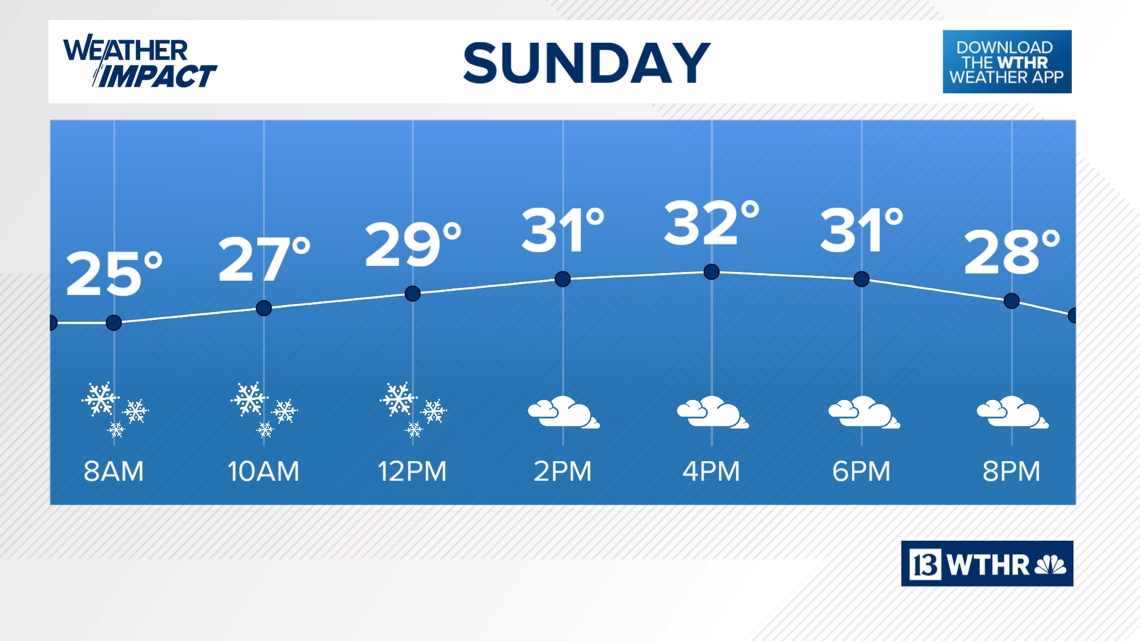
Less than an inch of accumulation is expected, with the amounts closer to 1 inch farther north and east of Indianapolis.

Daytime highs near freezing. Lows will be near 20. There may be a few snow showers during the afternoon, but additional accumulation is not likely.

MONDAY
Highs near freezing and lows near 20.
TUESDAY
REST OF NEXT WEEK
Temperatures will push close to 50 by Wednesday with scattered showers also in the forecast. Breezy conditions can be expected before cooler air arrives Thursday.
Scattered rain and snow mix showers are possible on Thursday. A few peeks of sunshine return on Friday with highs in the upper-40s.