
<!–>
Another round of patchy fog is out there this morning, dense in spots, as warm air tries to slip into Southeast Michigan.
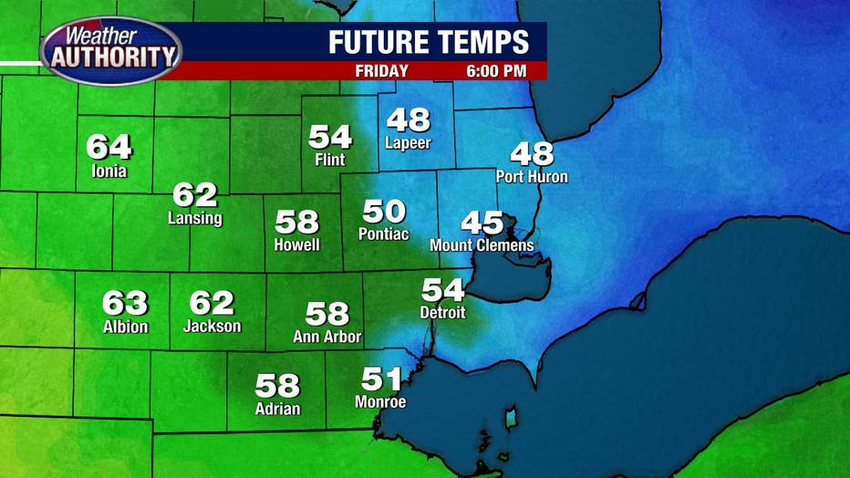
Temps today will be tricky. Many of us wind up in the 50s, a 60 is possible west, while 40s hang on north and east. Here’s a snapshot around sunset.
–>
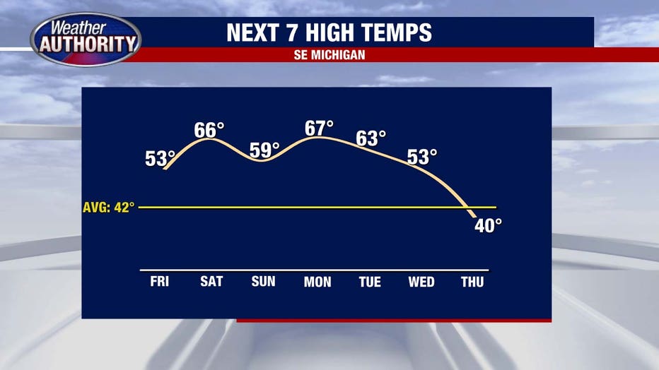
The real warmth surges in overnight, and by Saturday morning we’ll be near 60.
<!–>
Thunderstorm chances
–>
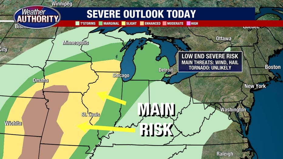
Today will be mostly dry with just a low chance for an afternoon storm.
<!–>
A better chance for rounds of storms arrives tonight and Saturday. The severe threat is low, but not zero. A marginal risk is in place with hail, gusty winds, and some localized flooding as the main concerns.
–>
<!–>
Temps drop Sunday, but that’s still my pick day of the weekend with sun and 50s, though we’ll be battling a bit of a breeze and the post-Daylight Saving Time grogginess after losing an hour of sleep Saturday night.
–>

<!–>
Temps climb Monday and we keep the rain away.
–>
Showers are possible Tuesday, likely Wednesday, with a cooldown to follow.
<!–>
–>