
FARGO, Ga. (WALB) – Firefighters continue battling a large wildfire burning in Clinch and Echols counties, according to the Georgia Forestry Commission.
The Pineland Road Fire has burned 32,331 acres approximately 13 miles northwest of Fargo, according to the Georgia Forestry Commission’s PIO Don Thomas. As of April 27, the fire is 10% contained with full suppression strategy in effect.
The fire started on April 18.
More on ‘What’s Going On’ at 11 a.m.:
Fire behavior and conditions
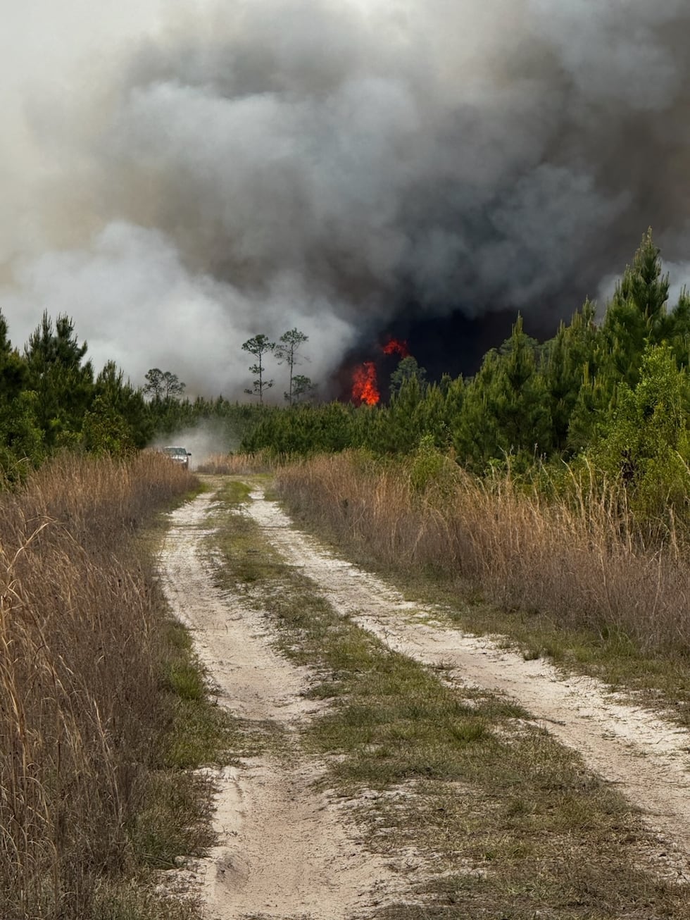
Fire behavior has been active with wind-driven runs, flanking and isolated torching, according to the Georgia Forestry Commission. Fuel and weather conditions are creating an extreme fire environment.
Low humidity in the mid-30% range, a high Keetch-Byram Drought Index approaching 700 and exceptional drought conditions are contributing to high fire resistance to control, according to the Georgia Forestry Commission. Spotting and rapid fire movement with wind and fuel-driven runs are increasing risks to responders.
The fire is burning in heavy southern rough fuels and bays, limiting access with heavy machinery, according to the Georgia Forestry Commission. Fuel conditions are extremely dry and the fire is resistant to control.
Structures threatened and damaged
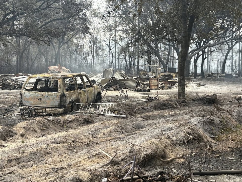
Structures including residences and recreational camps are threatened, particularly around the communities of Fruitland and Bamberg, according to the Georgia Forestry Commission.
187 single residences and 123 minor structures are currently threatened, according to the Georgia Forestry Commission. One single residence has been destroyed and 35 minor structures have been destroyed to date.
Critical infrastructure including transportation corridors, utilities transmission and railroad lines is currently threatened, according to the Georgia Forestry Commission.
Widespread damage has already occurred and is imminent to industrial timber production, according to the Georgia Forestry Commission. Commercial bee operations are also at risk throughout the incident area.
Evacuations
According to the Georgia Forestry Commission, 140 civilians have been evacuated as a result of the fire.
Residents in the affected areas should follow all instructions from local emergency management and law enforcement officials, according to the Georgia Forestry Commission.
According to Echols County Emergency Management, if you have not received an official evacuation alert, you are not under an evacuation order.
Road closures
According to the Georgia Forestry Commission, road closures are in effect in both counties.
Echols County: Pineland Road, Gopher Lope Road, Register, Worth Lane, Joes Lane, Will Rewis Road, New Barnes Road, Gaddis Road, King Road, Jesse Lane, May Lane, Chauncey Road, Hendley Road.
Clinch County: Colon Road, Mud Camp Road, Mattox Ford Road, Headlight Road.
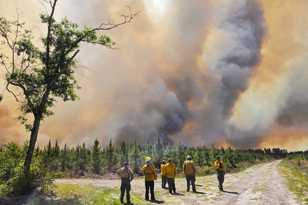
Firefighting efforts
The strategic objective is to keep the fire north of Highway 94, west of U.S. 441, south of Thelma Headlight Road and east of Will Rewis Road, according to the Georgia Forestry Commission.
Planned actions for the next operational period include continuing to establish and strengthen fire lines, addressing newly identified spot fires and improving fire lines to allow engine access for mop-up operations, according to the Georgia Forestry Commission. Air attack will continue to be utilized for fire suppression activities.
Critical resource needs include 12 tractor plows and 12 Type 4 or Type 6 engines, according to the Georgia Forestry Commission.
Total resources currently deployed include 62 total resources, 173 total personnel, 13 Type 6 engines, 48 tractor plows and 95 overhead personnel, according to the Georgia Forestry Commission.
Estimated incident costs to date are $3 million, according to the Georgia Forestry Commission.
Smoke impacts
Smoke impacts are likely in surrounding areas including Valdosta, Homerville and Fargo, according to the Georgia Forestry Commission.
The Georgia Forestry Commission reports over 30,000 acres have been affected.
Have a news tip or see an error that needs correction? Let us know. Please include the article’s headline in your message.
To stay up to date on all the latest news as it develops, follow WALB on Facebook and X (Twitter). For more South Georgia news, download the WALB News app from the Apple Store or Google Play.
Copyright 2026 WALB. All rights reserved.