
Future Melissa? Development Odds Increasing
Tropical Storm Melissa may develop in the Caribbean Sea sometime later this week, but its future beyond that is unclear, with several scenarios possible.
As we head into late October, the tropics aren’t ready to settle down quite yet.
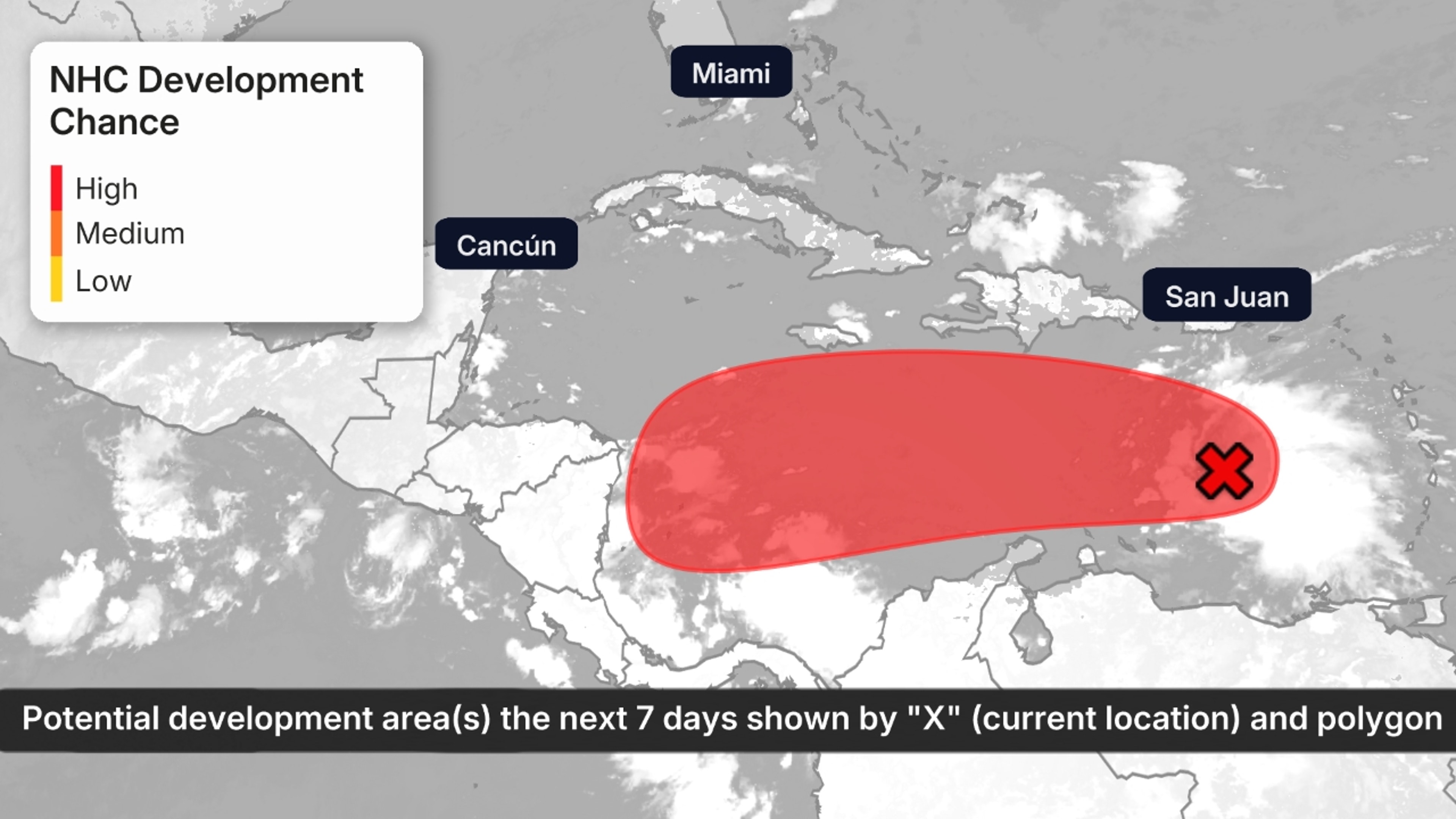
The National Hurricane Center is watching an area in the Caribbean Sea, that will likely develop, possibly as soon as mid-week. And this is a long-lived saga we’ll likely deal with well into next week.
Development In Caribbean
A disturbance known as a tropical wave is currently moving westward across the eastern Caribbean Sea. It’s being referred to by the National Hurricane Center as Invest 98L, a way for the NHC to identify systems that might develop, allowing for higher-resolution computer models to be run on the disturbance.
(MORE: What Is An Invest?)
There is a large area of showers and thunderstorms with this disturbance, with winds from 30 to 40 mph along its north and east flanks.
But the tropical wave’s quick forward speed and winds above the surface are creating wind shear that’s keeping the system from developing quicker at the moment.
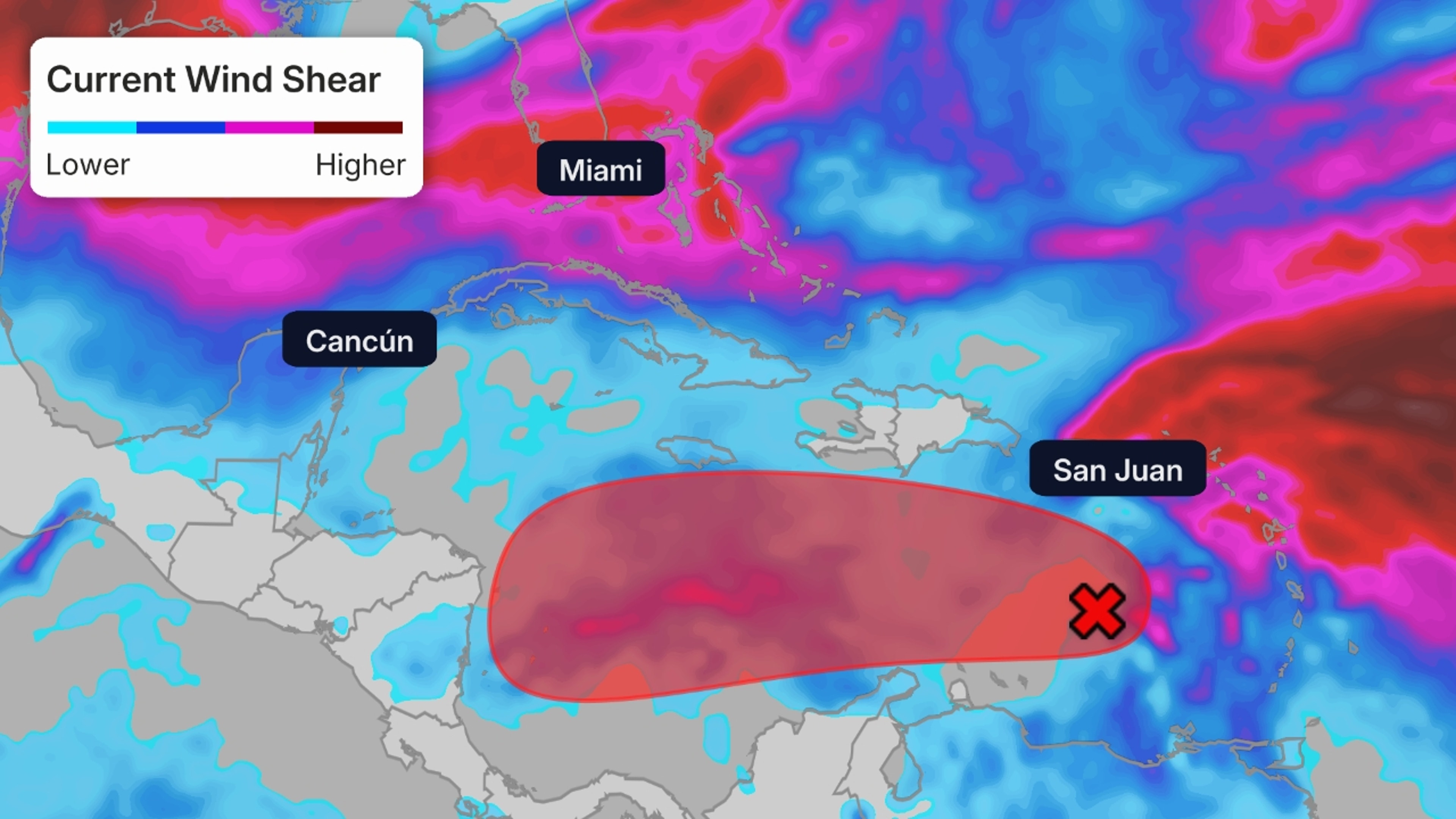
Wind Shear, Potential NHC Development Area
However, later this week, the disturbance should slow down, and that’s when tropical development becomes more likely.
With the most abundant supply of warm, deep water anywhere in the Atlantic Basin potentially serving as fuel, let’s take a look at the potential scenarios for “future Melissa”.
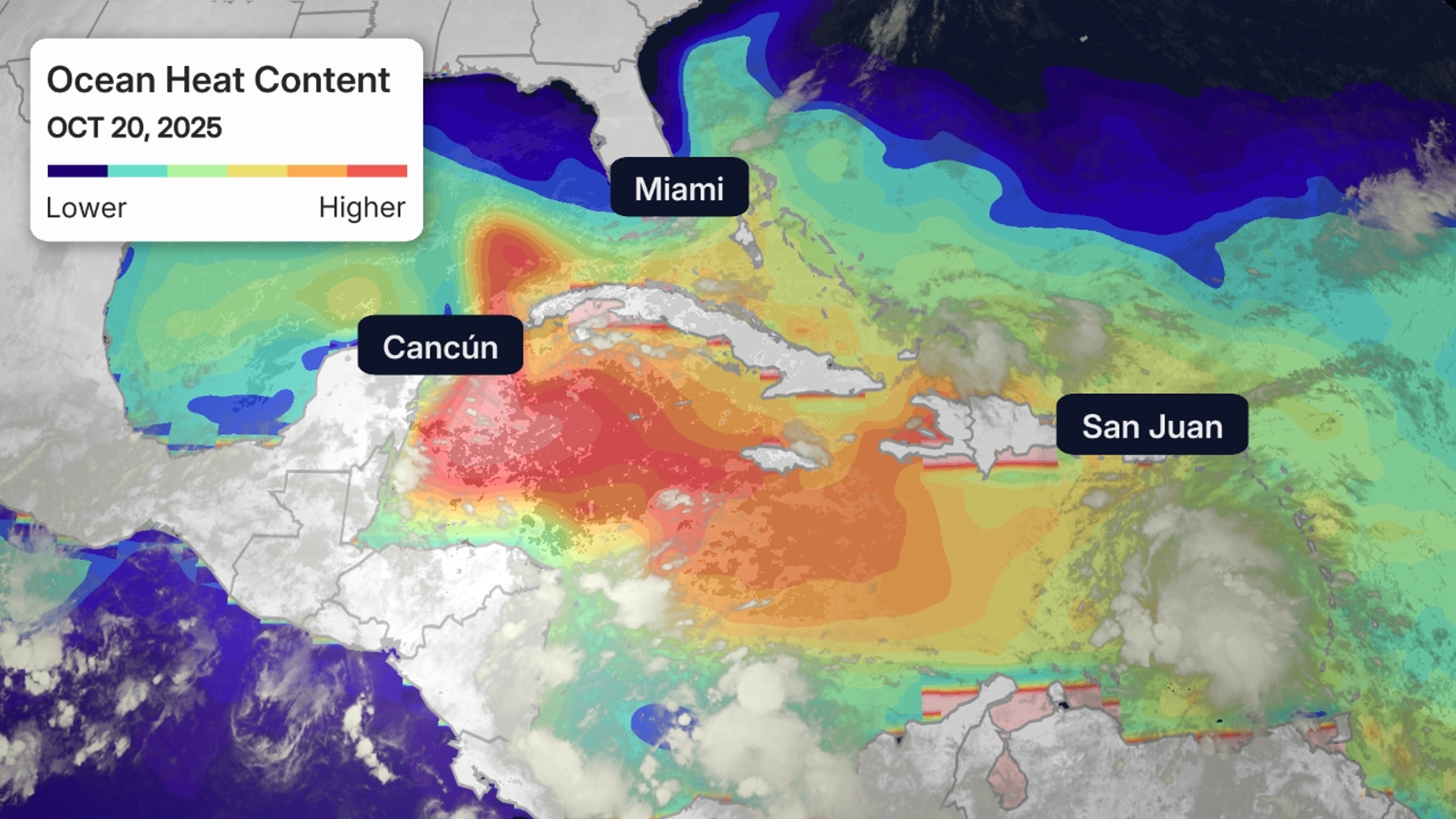
Ocean Heat Content
Possible Scenarios
For now, there appear to be three potential outcomes for what we expect to be Melissa:
- Quick northward turn: The system could develop into a named storm sooner over the central Caribbean Sea, curl northward and crawl over Hispaniola, before abruptly moving northeastward out to sea.
- Westward track into Central America: Rather than curve northward, Melissa may continue tracking westward over the bathtub-like waters into Central America.
- Later northward curve, potential U.S. impacts: A third scenario is that Melissa takes a later northward curve early-mid next week. This could potentially bring impacts to Cuba, the Bahamas and the U.S. later next week.
It’s too soon to tell which of these scenarios will occur. This has the potential to be a long, drawn-out affair lasting well into next week.
Check back with us at weather.com for the latest forecast updates.
Caitlin Kaiser graduated from the Georgia Institute of Technology with both an undergraduate and graduate degree in Earth and Atmospheric Sciences before starting her career as a digital meteorologist with weather.com.