<
div data-v-6fc2855c=””> <!–>
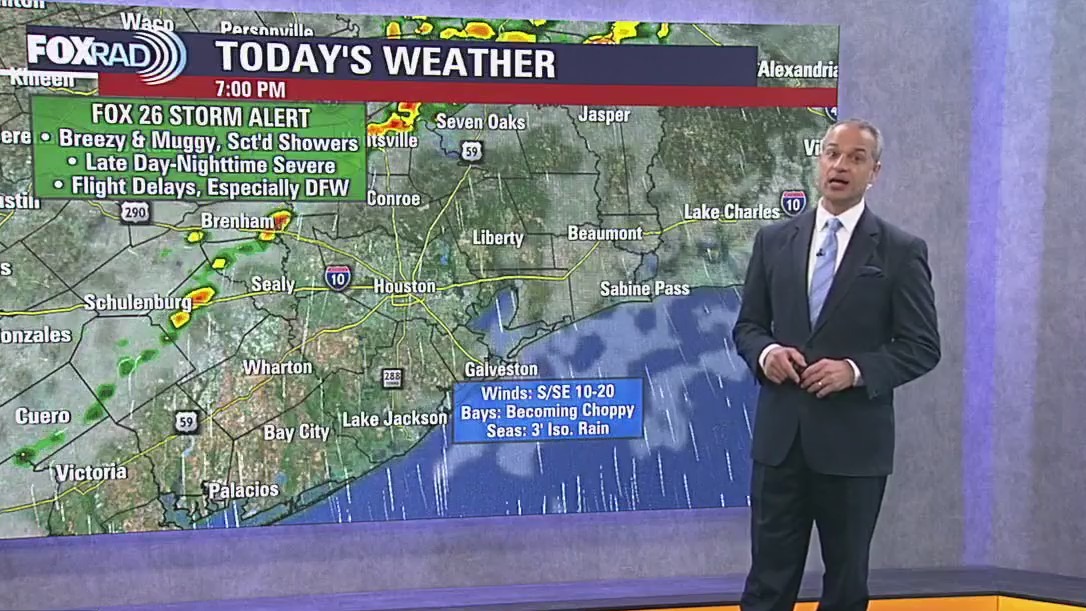
HOUSTON – Expect breezy and muggy weather this Monday afternoon. A FOX 26 Storm Alert is in effect for tonight and very early Tuesday.
Tornado Warning & Watch
–>
The National Weather Service has issued tornado watch for several counties near the Houston-area, including Austin, Brazos, Burleson, Fort Bend, Grimes, Harris, Houston, Liberty, Madison, Montgomery, Polk, San Jacinto, Trinity, Walker, Waller, and Washington.
Several cities are also included under this watch including Bellville, Brenham, Brookshire, Bryan, Caldwell, Cleveland, Coldspring, College Station, Conroe, Corrigan, Crockett, Dayton, First Colony, Groveton, Hempstead, Houston, Huntsville, Liberty, Livingston, Madisonville, Mission Bend, Missouri City, Navasota, Pecan Grove, Prairie View, Rosenberg, Sealy, Shepherd, Somerville, Sugar Land, The Woodlands, Trinity, and Waller.
<!–>
The watch is in effect until 7 p.m.
–>
A tornado warning has been issued by the National Weather Service for parts of Austin and Waller County until noon. A severe thunderstorm capable of producing a tornado was located near San Felipe, or near Sealy, moving northeast at 20 mph, according to the NWS.
<!–>
–>
Severe weather threat
<!–>
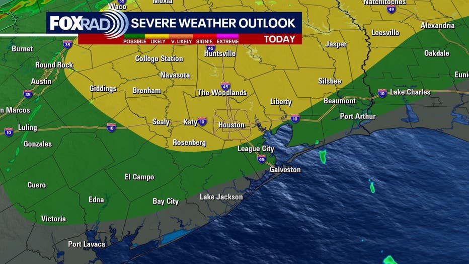
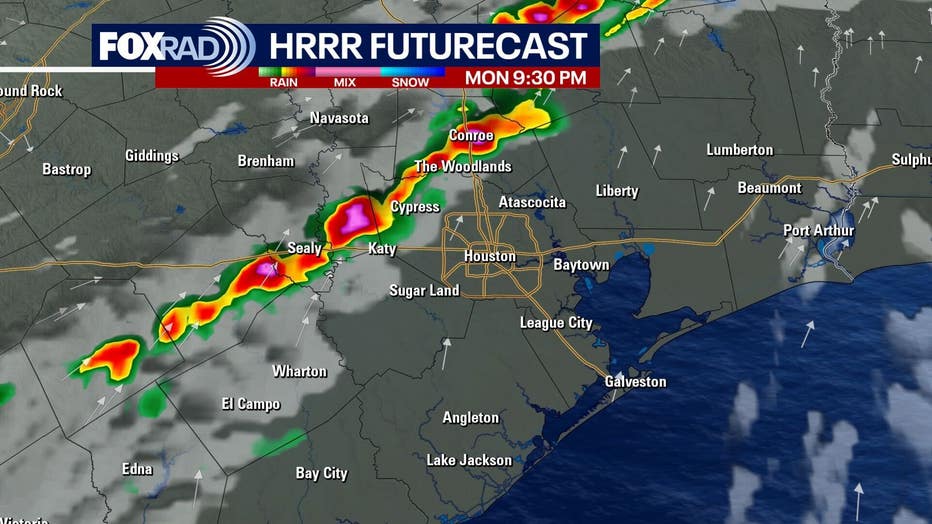
A cold front approaches today, helping spark showers and thunderstorms by mid to late afternoon. The strongest storms are expected mainly north of I-10 and west of I-45, where damaging winds, hail, and an isolated tornado are possible. Storms gradually shift south and weaken late tonight and early Tuesday as the boundary settles toward the coast.
–>
<
div class=”featured featured-video video-ct” data-v-7a5d4fdb=”” data-v-6fc2855c=””>
<
div class=”contain” data-v-7a5d4fdb=””>
<
div class=”video-wrapper” data-v-7a5d4fdb=””>
 <!–>
<!–>