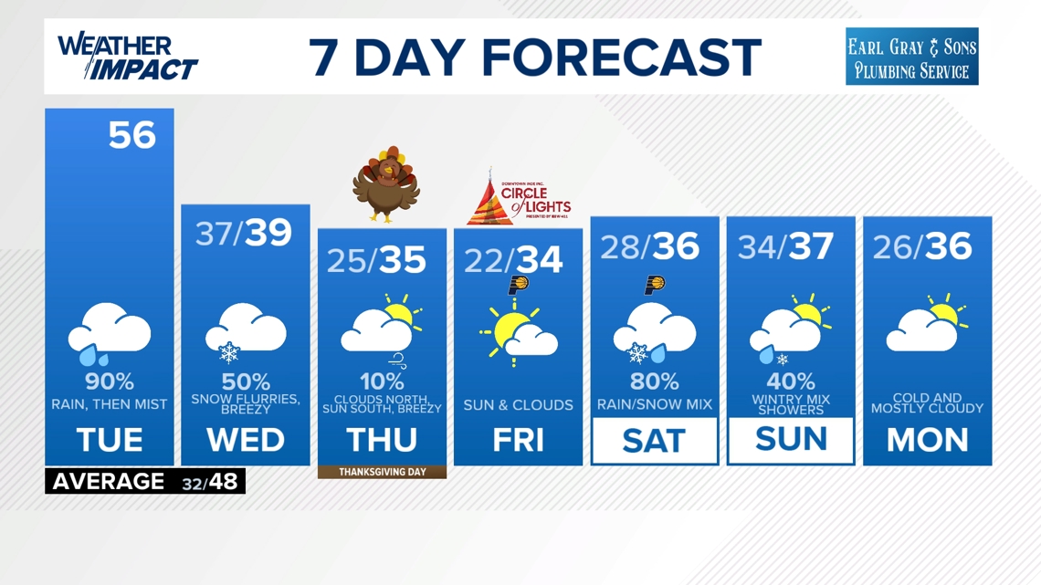
A damp day across Indiana brings scattered rain, mist and falling temps before Wednesday’s flurries. Track the rain zones.
Wet, gray Tuesday across Indiana with misty rain and a few morning rumbles
Tap HERE to track the rain showers with our interactive radar.
Rain will gradually become more showery and misty as the day goes on. Expect a gray, damp feel from morning through evening before colder air brings some flurry chances Wednesday.
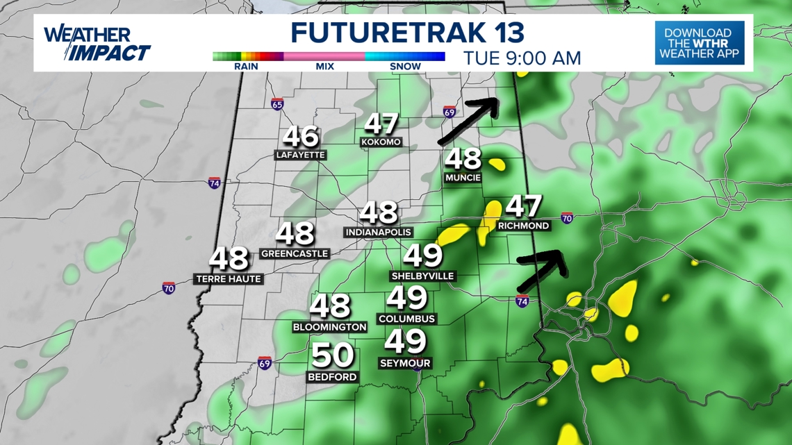
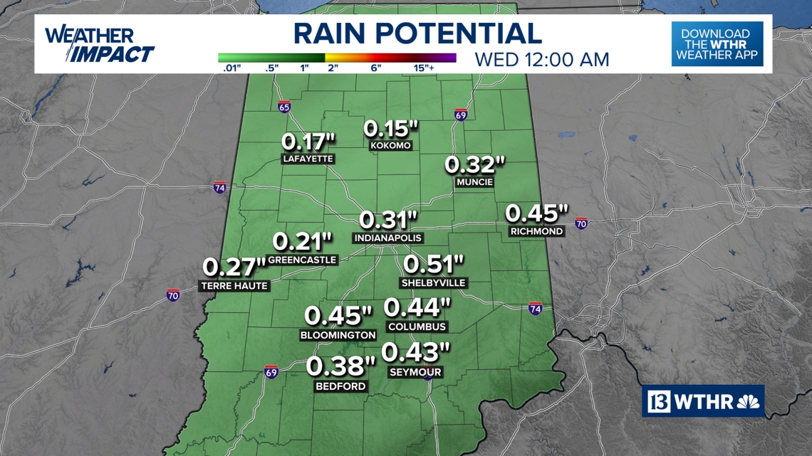
Rain zones: when it’s wettest today
Morning (heaviest/steadier rain)
- Widespread light rain, occasionally steady, especially south and east of Indianapolis
-
A low rumble of thunder possible
-
Wet roads statewide and likely staying wet most of the day
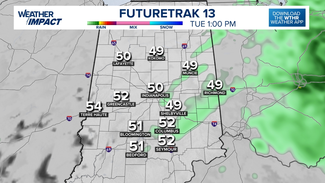
Afternoon (more showery)
- Scattered rain breaks up into on-and-off showers
-
Mist begins mixing in
-
Winds increase, making it feel cooler

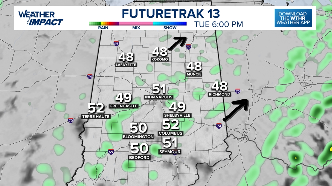
Evening (misty and damp)
- Mostly mist and pockets of drizzle
-
Some lingering showers
-
Breezy: gusts up to 25 mph (it will be windier Wednesday)
-
Temperatures sliding toward the 40s tonight

How much rain are we expecting?

Wednesday morning: Mist and flurries
Colder air pushes in overnight, lowering cloud bases and producing mist and a few flurries, mainly north of I-70. Central Indiana may also see flakes, while southern Indiana trends a bit brighter.

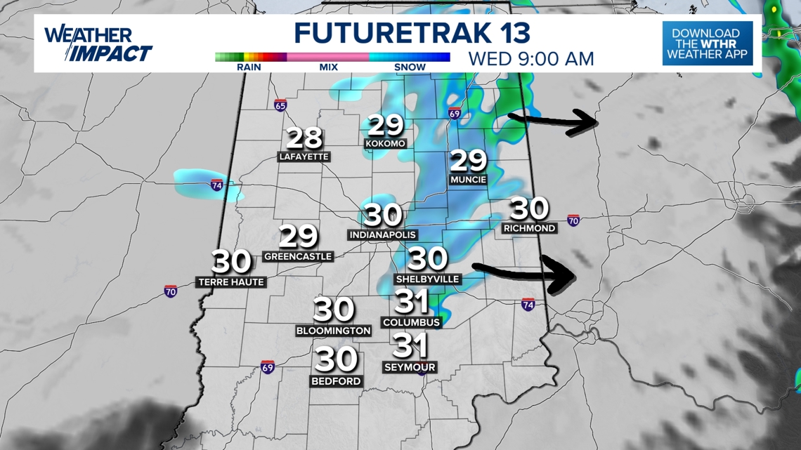
Expect a breezy Wednesday with west winds 15–25 mph and gusts up to 40 mph — creating a sharp wind chill.
– 13News Meteorologist Matt Standridge