
LAKE CHARLES, La. (KPLC) – We’re continuing to track rain and a nearby winter storm this weekend. Rain is likely for all of SWLA, but so is an ice threat especially for the northern half of our area.
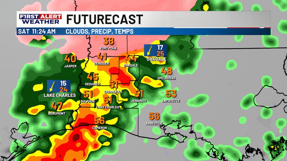
Saturday Morning and early afternoon: Showers and even some thunderstorms will become possible as the first part of the storm arrives. For most locations, this will just be plain rain. If cold air can move into Vernon Parish quickly enough, that’s where some freezing rain could mix in with a 20-30 degree temperature difference possible from north-to-south. Everywhere else will stay as plain rain.
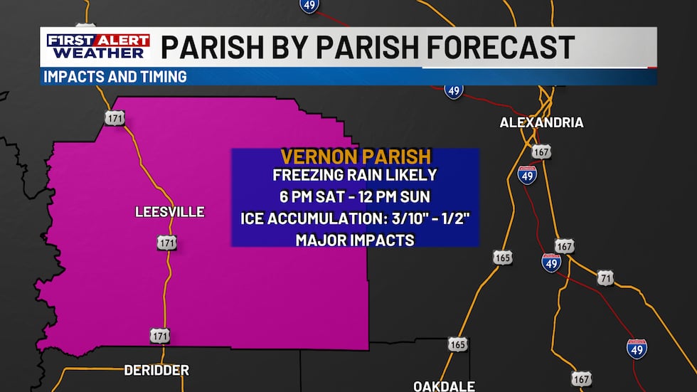
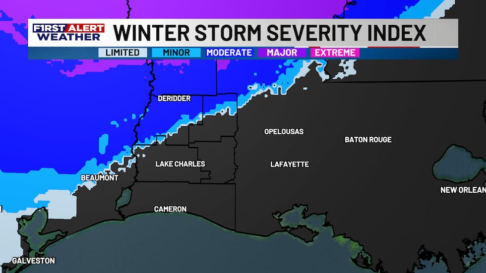
Saturday Night through Sunday Morning: The real concern arrives Saturday night into Sunday morning as rain and freezing rain arrives. While the greatest threat of ice will remain in northern Louisiana, Vernon Parish faces the highest risk of significant ice accumulation locally.
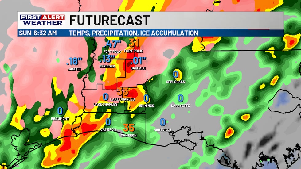
Potential ice accumulations have increased a bit for Vernon Parish with new totals between three-tenths and half an inch of ice possible through Sunday morning. If those amounts are realized, that could bring significant impacts to roads, power lines, and utilities.
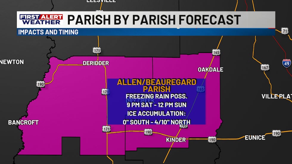
Ice amounts will dramatically decrease the farther south you are. With that said, Beauregard and Allen Parishes could see one-quarter to four-tenths of an inch of ice. The highest totals will be in far northern parts of the parishes, the potential includes locations such as Deridder and Oakdale. Totals will drop quickly for the southern parts of the parish.
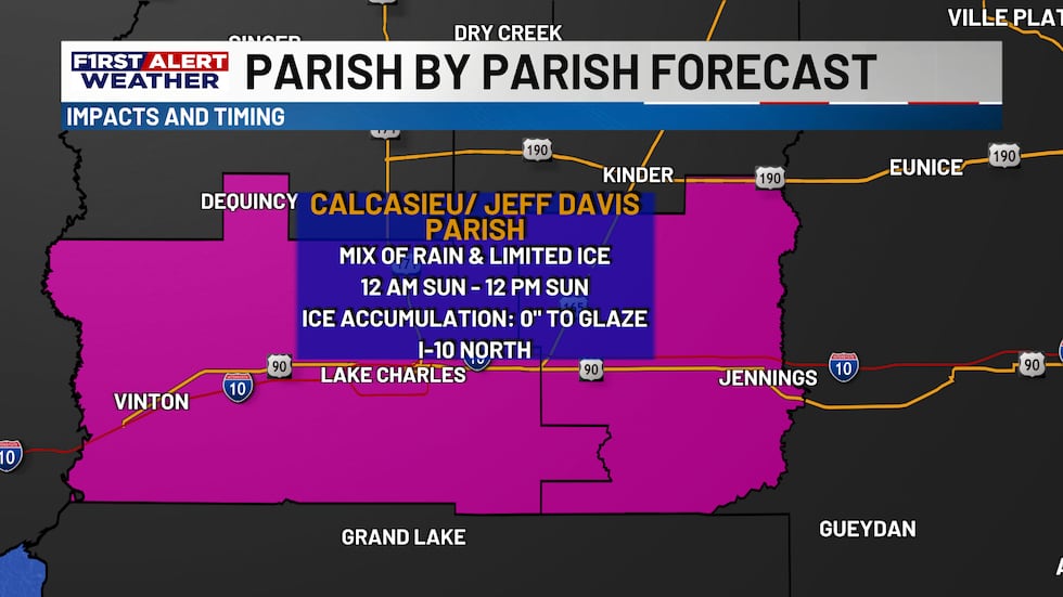
The odds of ice accumulation are even lower in Calcasieu and Jeff Davis Parishes, though a light glaze is still possible if temperatures can drop to freezing as precipitation takes place Sunday morning. Even a glaze of ice is still enough to cause issues on bridges and overpasses, so we’ll watch closely to see how cold we’ll get. In Cameron Parish, precip should stay as rain.
Then comes the arctic air. Bitterly cold temperatures arrive Monday morning with wind chills dropping into the single digits across the region and temperatures in the low 20’s to upper teens! Residents with vulnerable pipes or homes elevated off concrete slabs should take precautions.
There is a chance for black ice to form Sunday night into Monday morning, but that part of the forecast is more unclear. If winds can stay strong enough and push drier air in, it’s possible that threat turns out to be very limited. If not, then black ice will be more of a concern. We’ll know more Sunday after seeing how much precip has fallen and what conditions are.
What You Should Do:
- Prepare now for potential power outages
- Avoid travel Saturday evening through Sunday morning, especially any travel north
- Protect exposed pipes from freezing
- If you live in a home off the ground or have had pipe issues in the past, consider precautions by Sunday night
For Vernon Parish and Northern Beauregard and Allen where significant ice is most likely:
- Check which supplies you may need before the storm arrives
- Keep emergency supplies and flashlights handy, as some power outages will be a possibility
Stay tuned to the forecast this weekend as the First Alert Weather Team continues to track the latest.
Copyright 2026 KPLC. All rights reserved.