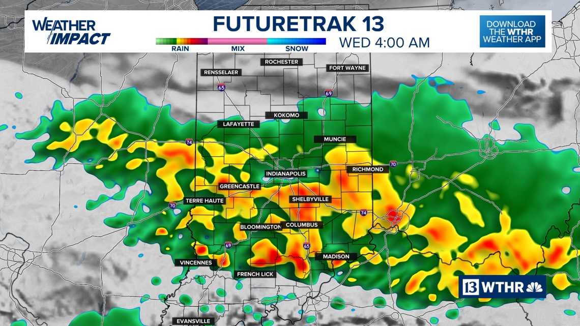
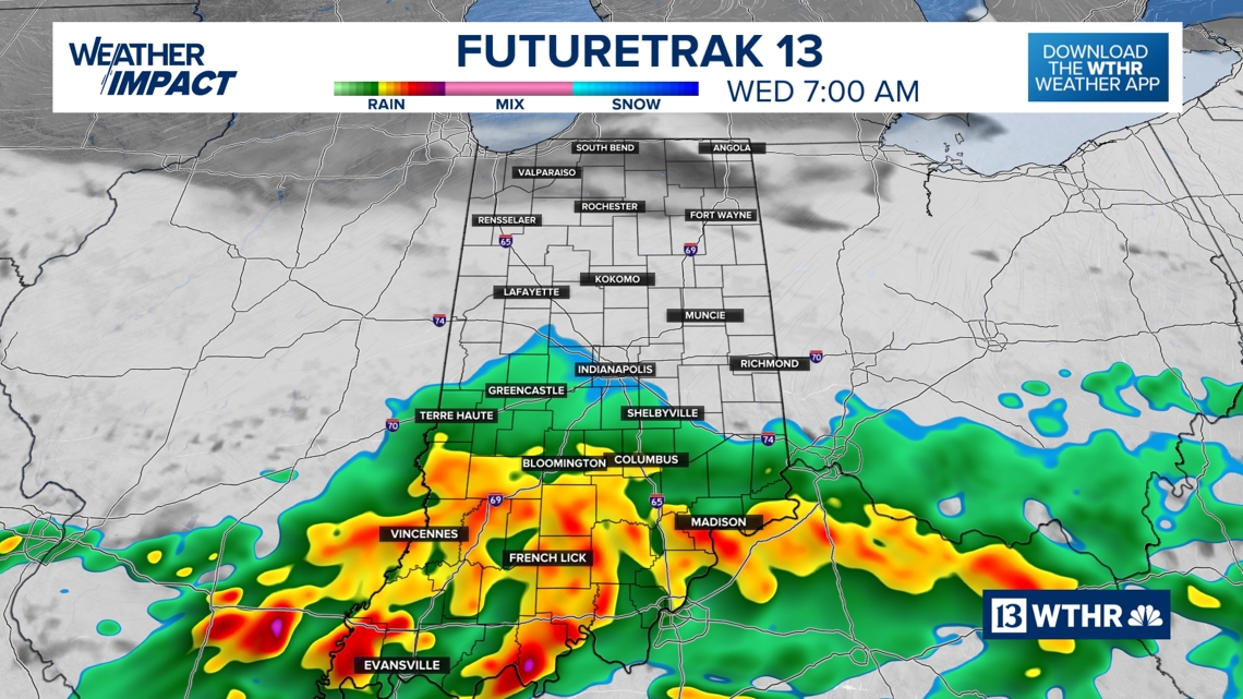
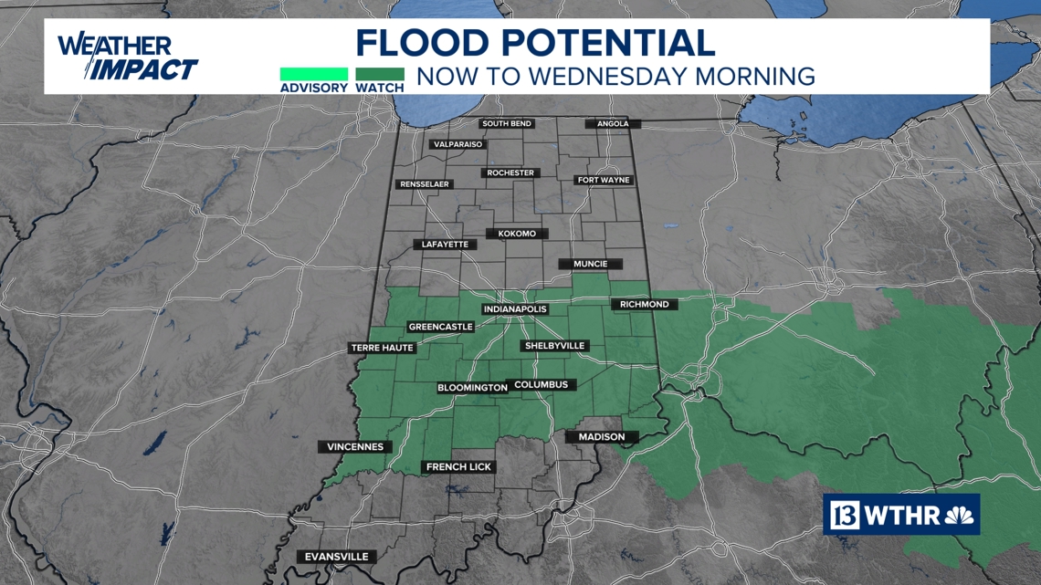
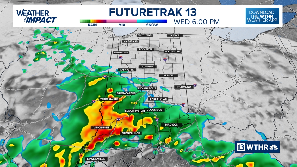
A zone of steady, heavy rain hits areas near and south of I-70 between now and Wednesday morning, with areas of flooding expected.

-
Street flooding
-
Rapid rises on creeks and streams
-
Ponding of water on roadways
-
Reduced visibility overnight
If you’re traveling overnight or early Wednesday, use extreme caution. Water-covered roads can be difficult to see in heavy rain and low light conditions. Remember: Turn around, don’t drown.


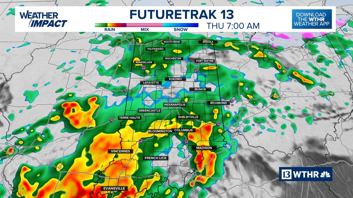
Severe storm risk south late Wednesday
Primary threats if storms strengthen are:
Again, flooding remains the higher-end concern area-wide.

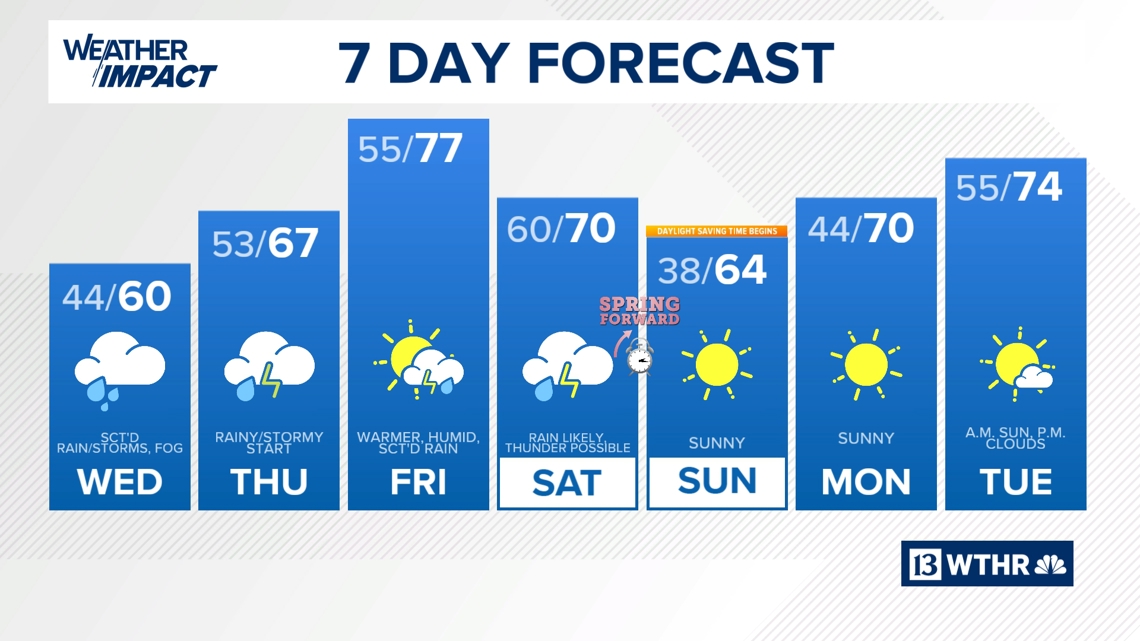
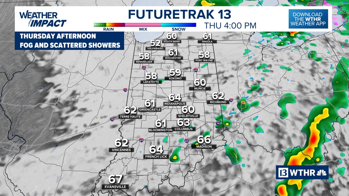
Thursday: Gradual improvement
Even as steadier rain ends, low clouds and damp conditions may hang on for part of the day.

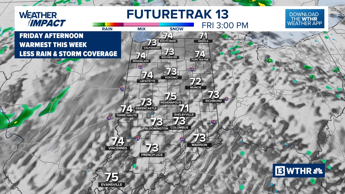
Friday: Warmer with spotty storms

Soggy Saturday to sunny Sunday
The payoff?
☀️ Sunshine
🌤️ Pleasant temperatures
🌬️ Drier air
A beautiful finish to the weekend appears likely.
Stay Weather Aware
This is an evolving forecast with multiple rounds of rain and storm chances. Be sure to:
-
Monitor rainfall totals in your area
-
Never drive through flooded roadways
-
Check for updated alerts before traveling
Stay Weather Aware, and check back with WTHR-TV for the latest forecast updates.