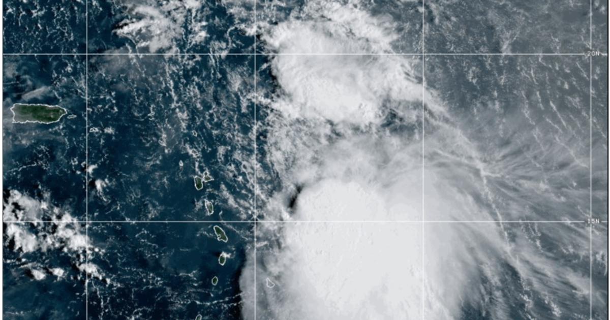
Forecasters with the National Hurricane Center in Miami said Thursday morning that Jerry will likely have turned out to sea by the time it becomes a hurricane. The NHC’s latest track forecast shows Jerry becoming a Cat 1 storm by Friday afternoon after passing near the northern Leeward Islands.
Because the storm’s strongest winds are on its east side, forecasters said the islands are not likely to face sustained tropical storm-force winds.
As of 7 a.m. Thursday, Jerry was 355 miles east-southeast of the northern Leeward Islands and producing maximum sustained winds of 65 mph. Forecasters said Jerry was moving west northwest at 20 mph.
Jerry is not a threat to Louisiana or the Gulf Coast, but a tropical storm watch was in effect for portions of the Caribbean as of Thursday morning.
Forecasters warned that those in the Leeward and Virgin islands should monitor Jerry’s development and expect heavy rainfall in some areas.
Area of low pressure in the north Atlantic
NHC forecasters also highlighted a non-tropical area of low pressure several hundred miles west-northwest of the Azores Thursday morning.
The disturbance was producing some showers near its center and had a low chance of developing.
While there is a chance of some development, forecasters said the system is expected to move into cooler waters with stronger wind shear. It is not a threat to Louisiana.
As of 7 a.m. Thursday, NHC forecasters said the disturbance had a 10% chance of forming within the next week.
